
How Aerial Mapping and Drone Surveys Are Transforming Modern Land Survey Services
The surveying industry has always depended on accuracy. But over the years, the way survey data is collected has changed dramatically. Projects today move faster, development areas are larger, and clients expect detailed information within shorter timelines. Because of this shift, aerial mapping and drone surveys are becoming a practical part of modern land survey services rather than just an advanced add-on.
Across the UAE, construction and real estate projects continue to expand at a rapid pace. From infrastructure developments and commercial projects to large residential communities, accurate survey information plays a major role in planning and execution. Traditional surveying methods still remain important, but drone technology is helping survey teams work more efficiently while improving the quality of data collected on-site.
Modern aerial surveys now support developers, engineers, consultants, and contractors by providing faster site analysis, clearer mapping data, and better visibility across active projects.
The Growing Need for Smarter Surveying
Surveying has become far more demanding than it was years ago. Earlier, many projects relied heavily on manual field measurements that required longer site visits and larger ground teams. While these methods are still useful in many situations, modern developments often require quicker turnaround times and more detailed reporting.
In fast-moving construction environments, delays in survey work can affect planning, approvals, earthworks, and even project schedules. This is one of the reasons why many land survey companies in UAE are integrating drone surveying into regular operations.
Drone technology helps reduce the amount of time needed for field data collection while still maintaining high levels of precision. Large areas can be surveyed much faster compared to conventional methods, especially on projects where terrain conditions or site access create challenges.
What Aerial Mapping and Drone Surveys Actually Involve
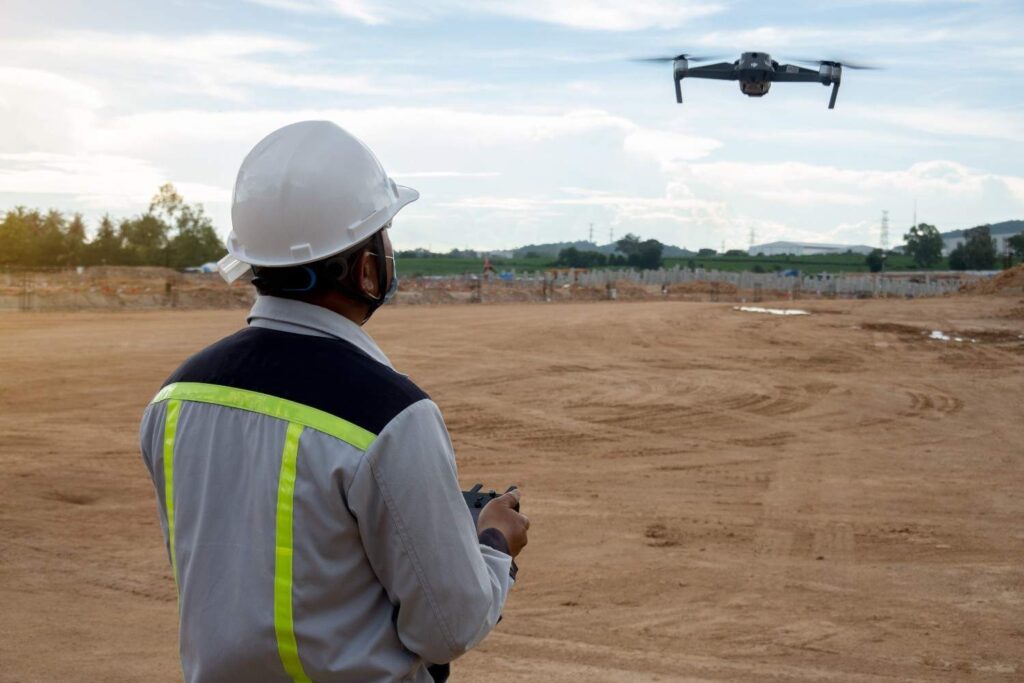
Aerial mapping uses drones equipped with high-resolution cameras, GPS systems, RTK technology, and advanced imaging sensors to capture site information from above.
Once the images are collected, specialised software processes the data to create detailed survey outputs such as:
- Topographic maps
- Orthomosaic imagery
- Elevation models
- 3D terrain visuals
- Point cloud data
- Volume calculations
- Site progress mapping
Instead of relying only on measurements taken from ground level, survey teams can now capture thousands of highly accurate data points through aerial imaging. This allows better visibility across the entire site and helps project teams identify important terrain and construction details much earlier.
Faster Data Collection Without Compromising Accuracy
One of the main reasons drone surveys are becoming more common is speed.
Traditional land surveys on large sites can take days depending on the size of the project, weather conditions, accessibility, and site complexity. Drone surveys can significantly reduce this time by covering larger areas within a shorter duration.
For active construction projects, this makes a noticeable difference. Faster survey updates help teams monitor progress more efficiently and avoid delays caused by outdated site information.
At the same time, speed alone is not enough in surveying. Accuracy remains critical.
Modern drone systems use RTK and PPK positioning technologies to improve measurement precision. These systems help generate accurate geospatial data suitable for engineering, planning, and construction applications.
This level of accuracy is especially useful for:
- Boundary verification
- Topographic surveys
- Construction staking
- Gate level surveys
- Quantity calculations
- Cut and fill analysis
- Demarcation works
- Control point establishment
Accurate survey information reduces the chances of construction errors, design conflicts, and rework during later project stages.
Better Visibility Across Construction Sites
Drone surveys also provide a clearer understanding of site conditions.
Traditional reports and field notes often give limited visual context, especially on large developments. Aerial mapping helps project teams view the entire site from a broader perspective.
This becomes useful during:
- Site planning
- Infrastructure layout analysis
- Earthwork monitoring
- Construction progress tracking
- Land development planning
- Utility coordination
Updated aerial data can help developers and consultants compare ongoing work against approved plans and identify changes before they become larger issues.
In many projects, regular aerial mapping is now used as part of overall project monitoring and reporting.
Safer Survey Operations in Difficult Areas
Some project locations are not easy to survey through conventional methods alone.
Large excavation zones, coastal developments, uneven terrain, high-traffic areas, and remote sites can create safety concerns for field survey teams. Drone technology helps reduce unnecessary exposure to hazardous conditions by allowing data collection from a safe distance.
This approach improves safety while also helping survey teams access locations that may otherwise require more manpower and time.
In UAE conditions, where heat and environmental factors can affect long outdoor operations, aerial surveying also supports more efficient fieldwork management.
Landscapes That Require Advanced Drone Survey Technology
While aerial mapping can support almost any type of survey project, certain landscapes and site conditions benefit much more from drone-based surveying.
Large development zones, uneven terrain, coastal areas, desert regions, and infrastructure corridors often require faster and broader site coverage than conventional surveying methods can easily provide.
In these environments, drone surveys help survey teams capture detailed information more efficiently while reducing operational difficulty.
Large Construction and Infrastructure Sites
Major construction projects usually involve constant site changes, ongoing earthworks, and multiple work zones operating at the same time. Drone surveys help monitor these changes regularly without slowing project activities.
This is particularly useful for:
- Highway and road projects
- Industrial developments
- Utility corridors
- Large residential communities
- Commercial construction zones
Frequent aerial mapping also helps project teams maintain updated records throughout different construction stages.
Desert and Open Land Areas
In regions with large desert landscapes, traditional ground surveys can become time-consuming due to heat, accessibility, and the sheer size of the terrain.
Drone technology allows surveyors to collect elevation data, terrain information, and boundary details across wide land parcels much faster.
For UAE projects, this has become especially valuable for land development planning and infrastructure expansion in remote areas.
Coastal and Marine-Adjacent Areas
Surveying near coastlines and waterfront developments can present additional challenges because of changing terrain conditions and accessibility limitations.
Drone surveys provide better visual coverage for:
- Coastal developments
- Waterfront construction
- Marina projects
- Reclamation areas
- Marine-adjacent infrastructure
Aerial mapping helps capture detailed site conditions while minimising operational disruption on active coastal projects.
Elevated or Difficult Terrain
Steep slopes, excavation zones, and uneven land surfaces often require additional manpower and safety measures during conventional survey work.
Drone surveys help reduce these difficulties by allowing data collection from above while limiting direct exposure to hazardous terrain conditions.
This improves both efficiency and field safety during survey operations.
Why Drone Surveys Matter for UAE Projects
The UAE continues to invest heavily in real estate, infrastructure, transportation, and smart urban development. These projects require highly accurate geospatial information for planning, approvals, and construction coordination.
As developments become larger and more technically demanding, survey requirements also become more detailed.
Drone mapping supports a wide range of industries and applications across the UAE, including:
- Real estate development
- Infrastructure construction
- Industrial projects
- Road and utility works
- Coastal developments
- Land development planning
- GIS mapping and analysis
The ability to collect detailed survey information quickly has become increasingly valuable for projects operating under strict timelines.
Technology Still Requires Professional Expertise
Although drone technology has improved the surveying process, accurate results still depend heavily on professional survey knowledge and proper data handling.
Survey equipment alone cannot guarantee reliable outputs. Every survey project still requires:
- Technical planning
- Proper control points
- Data verification
- Authority compliance
- Experienced survey interpretation
- Accurate reporting standards
Professional surveyors play a critical role in ensuring that the collected data is suitable for engineering, development, and regulatory requirements.
This is why experienced land survey companies in UAE continue to combine advanced technology with certified surveying expertise to deliver dependable results for clients.
The Future of Land Survey Services
Surveying technology will continue to evolve alongside the construction and development industries.
Drone surveys are already improving the way land data is collected, processed, and analyzed. As software, automation, LiDAR systems, and digital mapping technologies continue to develop, survey operations are expected to become even more efficient and data-driven.
For developers, consultants, and contractors, this means:
- Faster project planning
- Better site visibility
- Improved decision-making
- More accurate reporting
- Reduced operational delays
- Better coordination across project teams
Modern surveying is no longer limited to field measurements alone. It is becoming a combination of precision technology, digital mapping, and real-time project intelligence.
How Drone Technology is Changing Survey Reporting
Another major shift happening in modern surveying is the way project data is presented.
Earlier, many survey reports depended heavily on manual drawings, field sketches, and limited visual references. Today, aerial mapping provides clearer digital outputs that are easier for developers, engineers, consultants, and project managers to understand.
Drone-generated outputs can include:
- High-resolution aerial imagery
- Site progress visuals
- 3D terrain representations
- Digital elevation models
- Volumetric analysis reports
- Orthomosaic mapping
These reports help improve communication between project stakeholders because site conditions can be reviewed visually rather than relying only on technical measurements.
For large-scale developments, this level of visual reporting also supports faster planning discussions and better coordination between teams.
Conclusion
Aerial mapping and drone surveys are changing the way modern land survey services are carried out across the construction and real estate industries.
By improving efficiency, accuracy, site visibility, and safety, drone technology is helping survey teams deliver faster and more reliable project data. From topographic mapping and construction monitoring to quantity calculations and land development support, aerial surveying has become an important part of modern project planning.
As development activity continues to grow across the region, the demand for accurate and technology-driven survey solutions is expected to increase further. Many land survey companies in UAE are now adopting advanced aerial mapping technologies to support smarter, more efficient, and better-coordinated projects across the industry.